
This loop retraces the daily life of the Vieux Vernègues with courage and spirituality. Walking along this path, we feel as if life was with no frivolity. We imagine what they feel at that time. And don’t forget this Celto-Ligure place which is a journey through time many centuries before our era.
Description
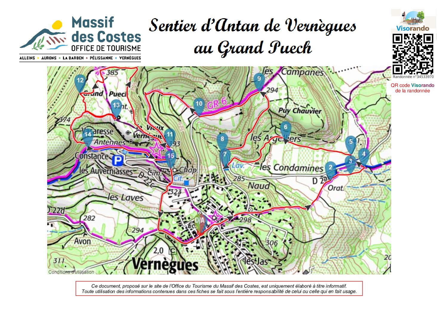
- Turn left onto the D22b for 320m, then take the Chemin de l’Oratoire, following the blue tracks.
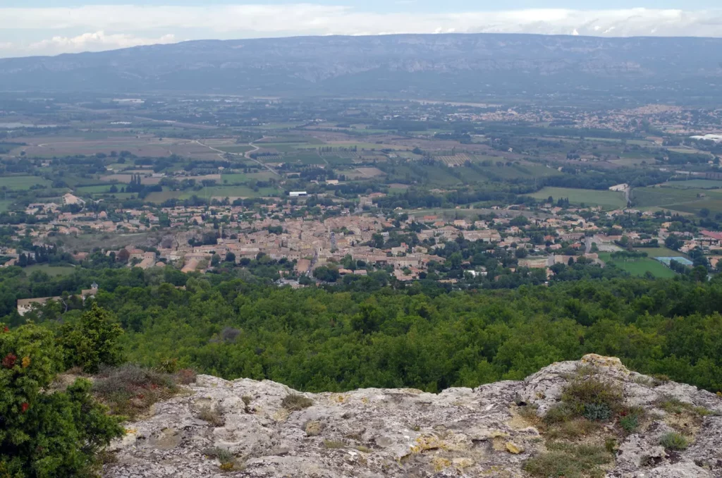
- As you navigate the rocky and rutted track (very difficult to see) and cross the picturesque plain, adorned with a breathtaking view of the Castle of Vernègues and the Oratoire which remain empty all year long to safeguard the precious statue within reserved solely for the annual procession day.
- From the Oratory, turn right and follow a narrow path parallel to the D22b, dotted with blue tracks to the next point.
- Turn left following the blue tracks and cross the D22b (there is traffic and go straight ahead for about sixty metres until you come to a barrier that is often open (ignore the no entry sign).
- Still following the blue tracks, follow the beautiful path bordered on the left by a very old olive grove and the silhouette of the Castle of Vernègues.
- Take the fork road on the left, a path bordered on the left by olive groves and a dry-stone wall on the right. Follow this path to the D22b road, which you must cross again to see the Naud washhouse.
- From the wash-house, go up a small path lined with brambles (regulary cut) which leads to the D22b just after a bend. You must cross the road again to reach a tarmac road, the path of Argelier.
- Follow this little-used road (although there is some traffic) for 600m, then turn left to join the GR6, which is signposted in red and white alongside the blue tracks.
- Then floow the double track on the road for 430m and leave it to take a trail on the right.
- 1Follow the double track (white, red and bleu marks) until the next point.
- Leave the GR6 on the right by a path along the ruins of the Castle of Vernègues. After a few metres take a little path and walk past the base stations to discover the palteau du grand puech, a viewpoint over Alleins with the Luberon, the Alilles and the Durance valley in the background. As you work your way through the vegetation on narrow, barely marked paths, you will come across the first stone burials of a major Celto-Ligurian necropolis.
- Continue along barely marked paths to the old mill, now a 360° orientation table.
- Retrace your steps and follow a shady path down from the plateau until you reach a wide track (the GR6) on the left.
- Take the GR6 and pass in front of “Le Repère”, a restaurant, cross the fence and 80m further, there is a staircase on the right leading to the Saint Jacques Chapel, which was destroyed by an earthquake on 11th June 1909.
- Walk past the small cemetery and then down a paved path to the D22b, turn left onto Rue des Alpilles Luberon and return to the starting point.
This document, published on the Massif des Costes Tourist Office website, is for information purposes only.
Any use of the information contained in these sheets is under the sole responsibility of the person making use of it.


