
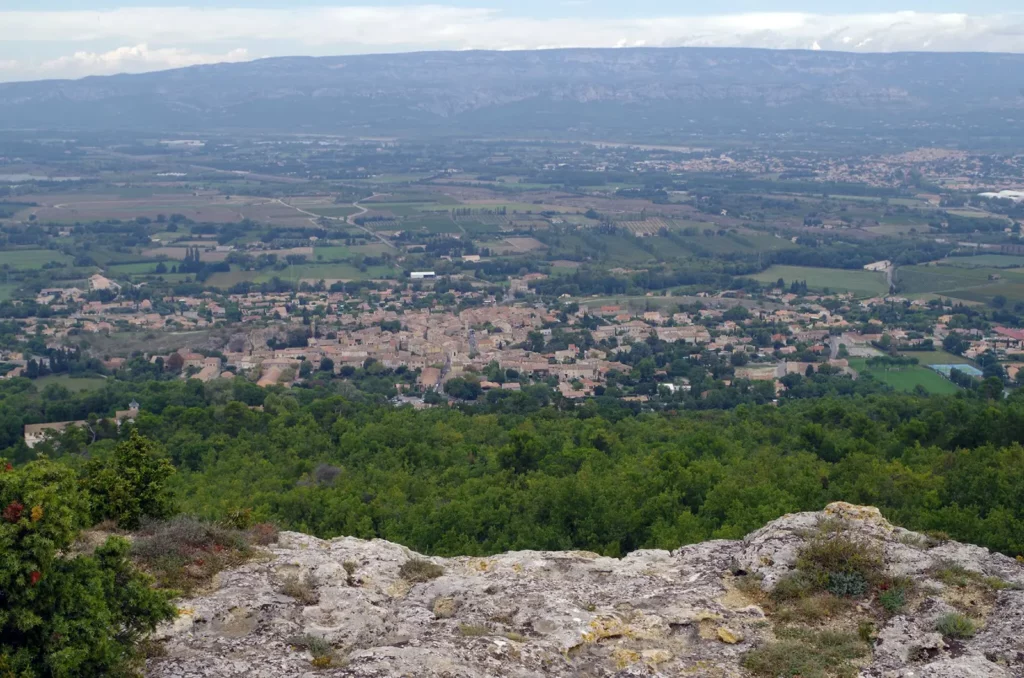
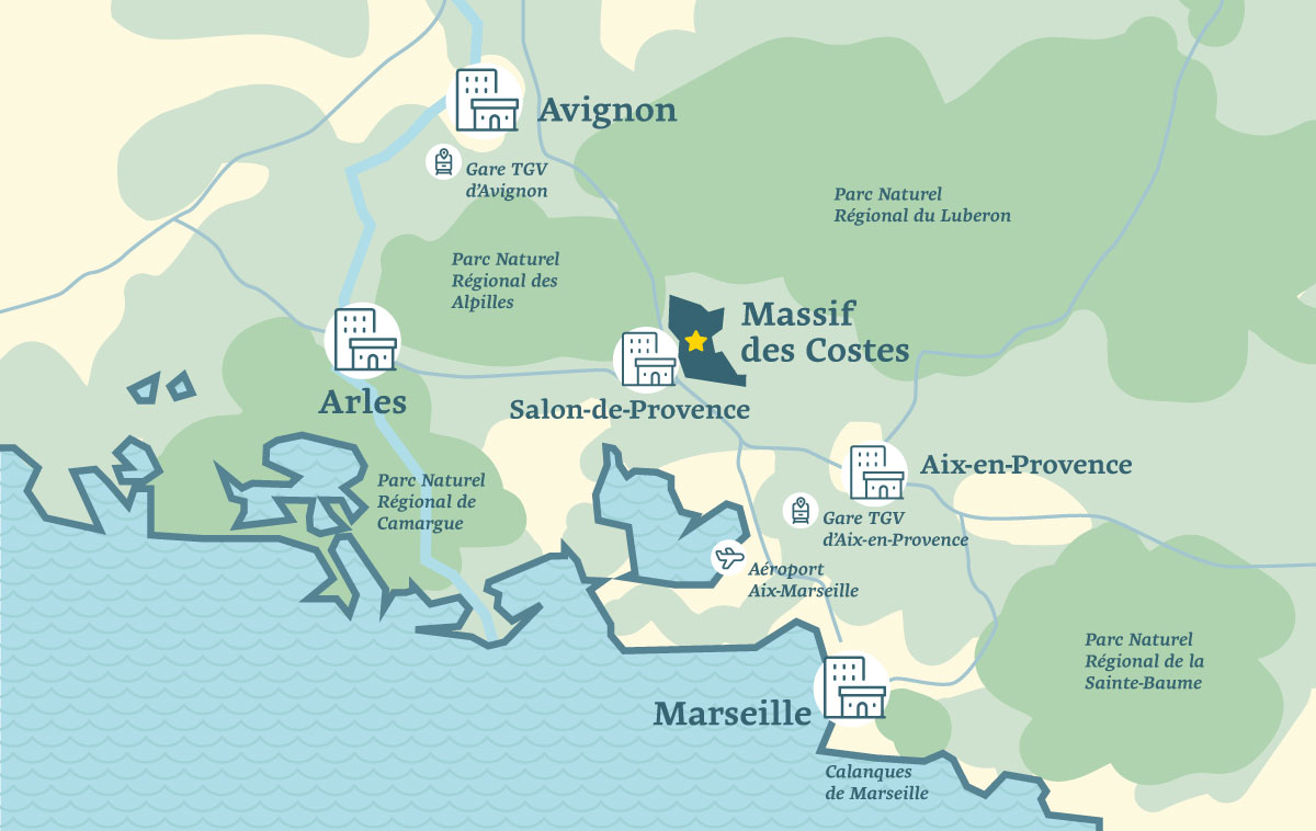
Situated at the east of the Autoroute du Soleil, the Tallagard plateau extends towards Aurons and Vernègues, offering accessible and enjoyable walking paths. Along the route, you’ll encounter several well-preserved bories. Additionally, the area boasts stunning panoramic views of the Alpilles, Mont Ventoux, Sainte-Baume, and Sainte-Victoire mountains.
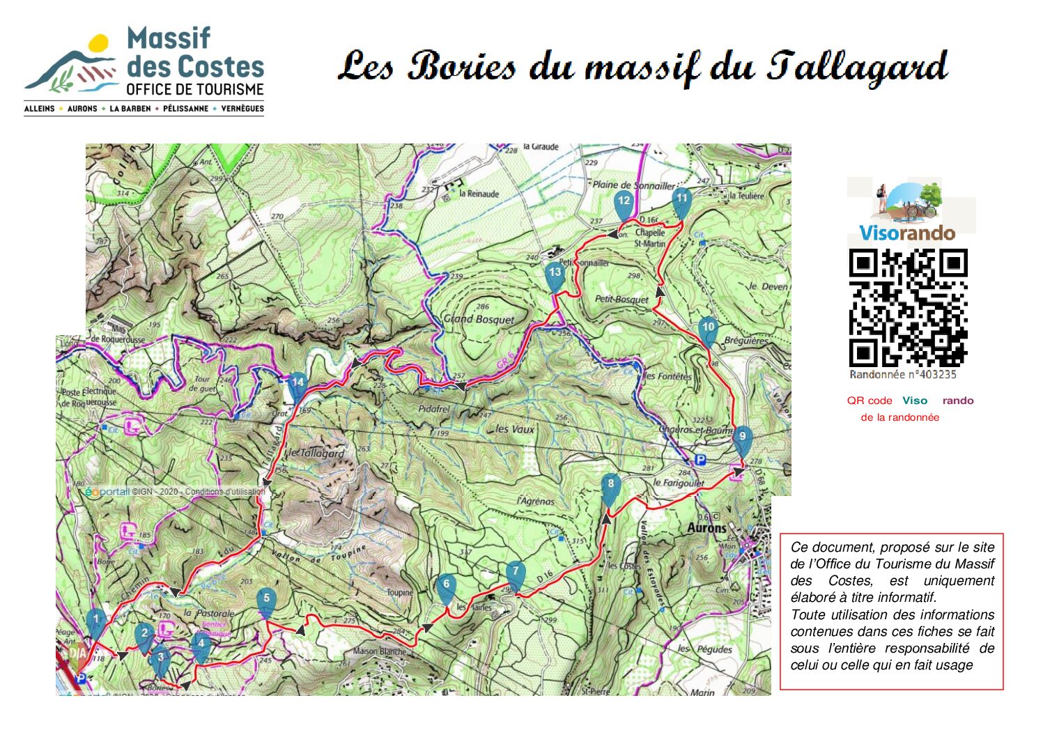
Description
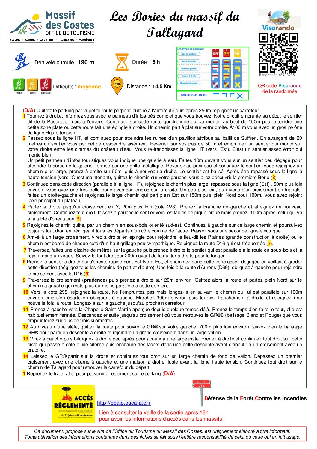
(D/A) Leave the car park via the small road perpendicular at the motorway, 250m further go to the crossroad.
- Turn right. Find out more on the comprehensive information board. Our route begins on the path known as the Pastoral, but in reverse. Continue this tarmac road, which climbs after 150m to reach a small flat area where the road bends to the right. A path runs off flat on your right. After 100 m, you’ll see a large high-voltage pylon.
- Pass under the HV line and continue to reach the ruins of a pavilion attributed to the Bailiff of Suffren. Go ahead 20 metres and take a path that leads you downwards. Retrace your steps 50 metres and take a path that climbs up on your right between the water tower cisterns. You will cross the HV line again (heading east). This is a narrow path that climbs well. A small tourist information board indicates a water gallery. Walk 10m ahead on a path that is not very clear to reach the exit of the gallery, which is closed off by a metal gate. Return to the signpost and continue along the path. You will come to a wider path, turn right for 50m, then right again. The path is signposted. After passing under the high-voltage power line again (now heading west), leave the path on your left and you will come to the first Borie (3).
- Continue this way (parallel at the HT lane), join the largest path and repass under the lane (east). About 50m further, there is a very beautiful boride with the enclosure on the right. A little further on, at the triangular junction, turn right and left and join the wide track that runs due east for 150m and then due north for 100m. You have now reached the main axis of the plateau.
- Go right as far as the Y junction 20m further on (mark 223). Take the left-hand branch and reach another crossroads. Continue straight ahead, leaving the path to the picnic tables on your left, but after 100m take the path to the orientation table (5).
- Rejoin the path you left by taking a path through undergrowth facing south-east. Keep to the left on this wide track and continue straight ahead, ignoring all the switchbacks on either side. Pass under a second power line.
- At a wide crossroads, turn right in a hairpin bend to reach a place called Les Plaines (large building on the right), where the path is bordered on either side by a high fence that is not very attractive. Join the busy D16 road (7).
- Cross the road, go about ten metres to the left and then turn right onto the path that runs parallel to the road in the undergrowth and joins it at a bend. Follow the road straight ahead for 200m before turning right to go alongside it.
- Take the path on the right oriented to the north-east, walk in this zone (don’t take anu other path). Once on the road to Aurons (D69), turn left to join the crossroad of the D16. (9)
- Cross the crossroads (take care) and then turn right for about 20m. Leave the road and head due north on the track on your left, which runs more or less parallel to the road.
- At around marker 298, join the road. Don’t take the road, but walk alongside it, following the path that runs parallel to it for around 100m and then bends left away from it. Walk for about 300m, then turn right and rejoin the road. Follow it to the left until you reach the next crossroads.
- Turn left towards the Chapelle Saint-Martin, which you saw some time ago. Take the time to walk around it, as it is usually closed. Then head downhill to the crossroads, where you’ll find the GR®6 (white and red markings), which you’ll follow for over three kilometres.
- At a steel, leave the road and follow the GR® to your left. After around 700m, follow the GR® signs downhill to the right to reach a large crossroads in a wide valley.
- Turn left and then right shortly after to reach a wide track. Turn right and continue straight ahead on this track, which runs past a cistern and then twists and turns downhill before coming to a junction with an oratory.
- Let the GR® go off to the right and continue straight ahead on a wide track at the bottom of the valley. Go past the first crossroads with a cistern on your left and a house on your right, just before the high-voltage power line. Continue straight ahead on the chemin de Tallagard back to the starting crossroads.
- Return to the outward journey to arrive directly at the car park. (D/A)
This document, published on the Massif des Costes Tourist Office website, is for information purposes only.
Any use of the information contained in these sheets is under the sole responsibility of the person making use of it.


